FLORIDA, USA — Upgrades are coming to the National Hurricane Center’s products for the 2025 season to help communicate wind risk.
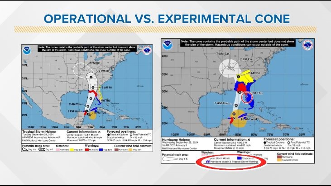
The current operational cone from the National Hurricane Center (NHC) only shows watches and warnings along the coastline. In 2024, the NHC issued experimental cones depicting inland watches and warnings to help communicate wind risk away from the coast. While fairly successful, the NHC received feedback on how to make their maps clearer.
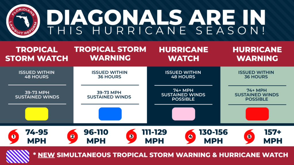
Diagonal pink and blue lines depict where a tropical storm warning and hurricane watch are simultaneously happening. You will now see this symbol on the legend.

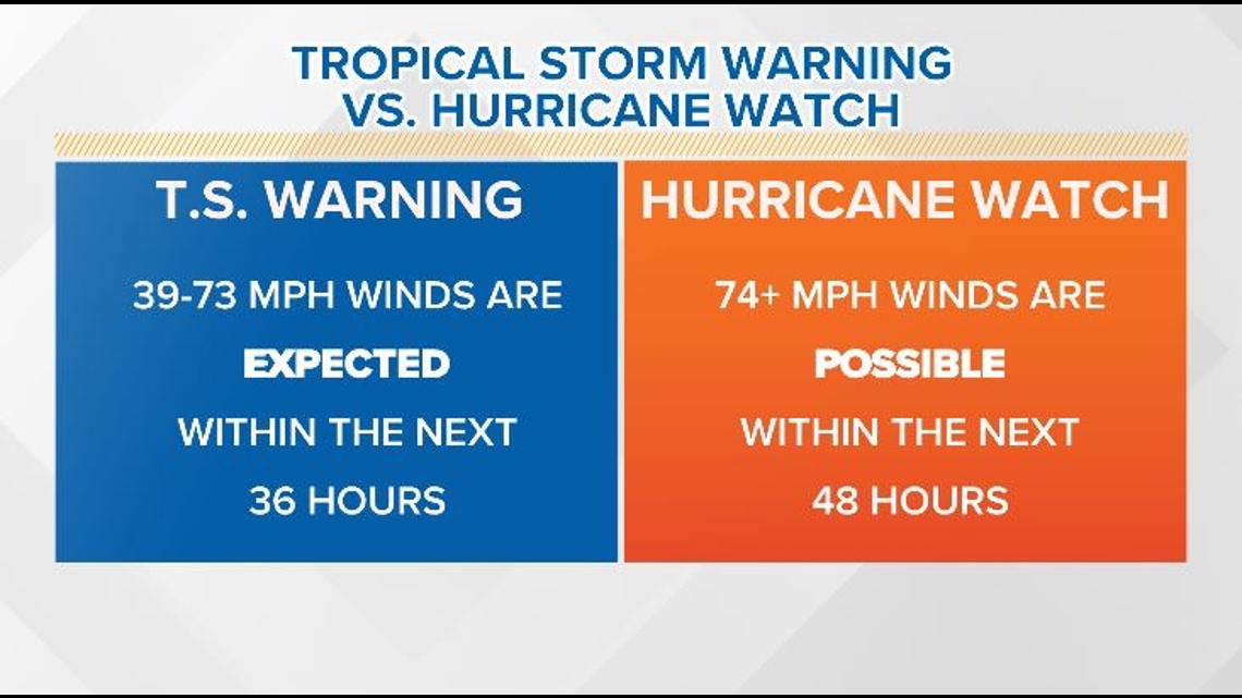
It is important to know what watches and warnings you’re under and what they mean. Tropical storm warnings and hurricane watches can happen at the same time over the same area.
A tropical storm warning is issued when sustained winds of 39-73 mph are expected, meaning tropical storm strength winds are likely going to happen.
A hurricane watch is issued when winds of 74 mph or higher are possible. The watch does not mean that hurricane conditions will absolutely occur, they’re just possible.

If you land under a diagonal blue and pink shaded area on the National Hurricane Center’s cone, expect tropical storm strength winds but be prepared for winds of 74+ mph, just in case.
Stay up to date on Jacksonville’s forecast here.